Mozambique—Consultancy and Technical Assistance to the MCA Land Component
Client: Millennium Challenge Account
Duration: 2009-2013
Region: Sub-Saharan Africa
Country: Mozambique
Solutions: Economic Growth Environment
Land administration in Mozambique has been seriously under-resourced, and needed new, modern systems in place to be able to deal with the increasing demands being placed upon it. The principal aim of this support programme to four provinces was to improve the efficiency of the land rights management and registration system. Analysis and assessment of existing systems within the context of ongoing policy discussions at central level were undertaken. This provided a basis for developing a plan to improve this system and provide better access to land-related services for all land users.

Sample Activities
- Support legal and land policy reform, including development of new regulations.
- Assess and improve the cadastre in rural, urban and peri-urban settings, including capacity building that allow the systematic regularisation of land tenure in selected areas and improved, more flexible methods for delimitation and demarcation.
- Carry out systematic registration and Land Tenure Regularization in both urban and rural areas.
- Assess the best way to manage and facilitate the transfer of rights between third parties, and the registration of transfers in cadastral records.
- Develop baseline information, including land resources, land use inventory, planning methodologies, and current spatial distribution of tenure and land occupation.
- Develop land use plans as an outcome of improved delimitation and demarcation of existing rights; the identification of areas available for investment; and the effective registration and recording of a wide range of land and related information.
Select Results
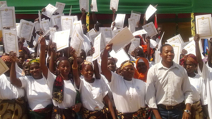
- Registered 198,764 parcels and issued 157,167 full land titles (DUATs), between March 2011 and August 2013 in the four northern provinces of Mozambique.
- Secured land rights for women—35 percent of all titles were issued to women as single title-holders and another 12 percent were co-titled.
- Produced 20 land use and cover maps, covering eight municipalities (focused on land use) and 12 districts (focused on land cover).
- Designed, produced, and implemented a new national information system to record land ownership and transactions, called LIMS (Land Information Management System) in English or SIGIT (Sistema de Gestão de Informação sobre a Terra) in Portuguese.
Featured Links
RELATED CONTENT:
Worldwide—Climate Finance Accelerator 2 (CFA 2)
The Climate Finance Accelerator 2 (CFA 2) is the second phase of a technical assistance program that brings together project proponents, investors, and policy makers to increase flows of climate finance.
Read More